Log in
All resources
Create a design
Tools
10,854 Free Images of Historic Map
pages with maps
cc-zero
national register of historic places with known ids
gemeente atlas van nederland - south holland
1860s maps of south holland
architecture
images from wiki loves monuments 2020
images from wiki loves monuments 2020 in utah
images from wiki loves monuments 2020 in the united states
uploaded via campaign:wlm-us
architecture
town
historical images of the moscow kremlin
17th-century maps of moscow
historical maps of the county of kłodzko
coats of arms of county of kladsko
maps of bamberg by braun & hogenberg
gangulphus
topographia braunschweig lüneburg (merian)
baroque
gemeente atlas van nederland - south holland
19th-century maps of rotterdam
maps
flag
gemeente atlas van nederland - north holland
maps of schermer
gemeente atlas van nederland - south holland
maps of hendrik-ido-ambacht
gemeente atlas van nederland - south holland
1860s maps of south holland
gemeente atlas van nederland - south holland
maps of ameide
st. helena - a physical, historical, and topographical description of the island (1875) by melliss
maps from the mechanical curator collection
historical images of the hôtel d'angoulême lamoignon
turgot map of paris – derivative files
david rumsey historical map collection
maps of rügen by eilhard lubinus
gemeente atlas van nederland - north holland
1860s maps of north holland
gemeente atlas van nederland - south holland
1860s maps of south holland
gemeente atlas van nederland - south holland
1860s maps of south holland
media from the national library of finland
classicism
architecture
lawn
cityscape
city
self-published work
town
self-published work
pages with maps
architecture
village
self-published work
tree
self-published work
architecture
self-published work
village
self-published work
architecture
self-published work
architecture
self-published work
architecture
village
roof
travel
city
architecture
village
romanticism
1557 maps
gemeente atlas van nederland - north holland
19th-century maps of amsterdam
winter
snow
self-published work
pages with maps
maps of the ottoman empire by mercator-hondius
eran laor cartographic collection
gemeente atlas van nederland - north holland
maps of bergen, north holland
historisk atlas (stockholm, norstedt & söner, 1880)
19th-century maps of the british isles
maps in the library of congress
pont-aven school
historisk atlas (stockholm, norstedt & söner, 1880)
old maps of the polish-lithuanian commonwealth
self-published work
vehicle
maps of the ottoman empire by mercator-hondius
eran laor cartographic collection
prato in the 20th century
maps of prato
maps by willem and johannes blaeu
1651 in germany
gemeente atlas van nederland - south holland
1860s maps of south holland
historisk atlas (stockholm, norstedt & söner, 1880)
old maps of the carolingian empire
john rocque's 1746 map of london
details of old maps of london
topographia westphaliae (merian)
baroque
historical images of chamonix
maps of glaciers
architecture
town
gemeente atlas van nederland - south holland
1860s maps of south holland
maps of 12th-century asia
maps of the crusades
pages with maps
architecture
architecture
sidewalk
maps of nieuwpoort, south-holland
vestingwerken nieuwpoort
gemeente atlas van nederland - south holland
maps of nieuwenhoorn
gemeente atlas van nederland - south holland
1860s maps of south holland
turgot map of paris, david rumsey historical map collection – derivative files
église saint-sulpice on old maps
eran laor cartographic collection
adolf eltzner
media from the national library of finland
classicism
old maps of île de la cité
old submaps of paris
old maps of chania
1651 in chania
gemeente atlas van nederland - north holland
old maps of amsterdam
media from the national library of finland
classicism
travel
city
self-published work
architecture
architecture
water
architecture
town
self-published work
architecture
self-published work
pages with maps
self-published work
pages with maps
self-published work
pages with maps
media from the national library of finland
classicism
media from the national library of finland
classicism
gemeente atlas van nederland - south holland
old maps of the hague
gemeente atlas van nederland - south holland
19th-century maps of rotterdam
self-published work
pages with maps
sidewalk
pavement
self-published work
village
self-published work
winter
gemeente atlas van nederland - south holland
maps of krimpen aan de lek
maps from the mechanical curator collection available to georeference
maps from the mechanical curator collection
turgot map of paris, david rumsey historical map collection – derivative files
historical images of luxembourg palace
gemeente atlas van nederland - south holland
19th-century maps of rotterdam
gemeente atlas van nederland - south holland
1860s maps of south holland
16th-century maps of the philippines
maps by pieter van der keere
gemeente atlas van nederland - south holland
1860s maps of south holland
gemeente atlas van nederland - north holland
old maps of alkmaar
gemeente atlas van nederland - south holland
19th-century maps of rotterdam
maps made in the 17th century
old maps of lindau (bodensee)
gemeente atlas van nederland - south holland
giessen (river south-holland)
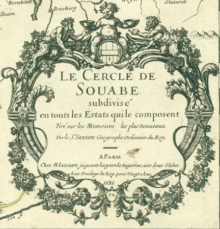
cartouches by alexis-hubert jaillot
sanson (surname)
gemeente atlas van nederland - north holland
maps of beemster
maps of nieuw-helvoet
nieuw-helvoet
gemeente atlas van nederland - south holland
giessen (river south-holland)
gemeente atlas van nederland - south holland
maps of waddinxveen
historical maps of crema
maps by pieter mortier
sicilia (galleria delle carte geografiche)
1580s maps of sicily
hamburgische elbkarte von melchior lorichs
historical maps of uetersen
4701 - 4800 of 10,854
Next page
/ 109